

Whole Dude – Whole Promise – Walong Will Never Fall Again

This is my special tribute to Lohit River and I post this blog to remember my life’s journey; a journey from 1962 to 1972. During 1962, I was a student at Giriraj Government Arts College, Nizamabad, Andhra Pradesh (now Telengana), India and I was studying in the First Year of a 3-Year Bachelor of Science Degree Course. During October 1962, when China attacked India across the Himalayan Frontier, Indian people spontaneously reacted condemning the act of Chinese aggression. It gave me a strong motivation to serve the country to defend the Northern Frontier. My dream came true during 1969 when I was granted Short Service Regular Commission to join the Indian Army Medical Corps.

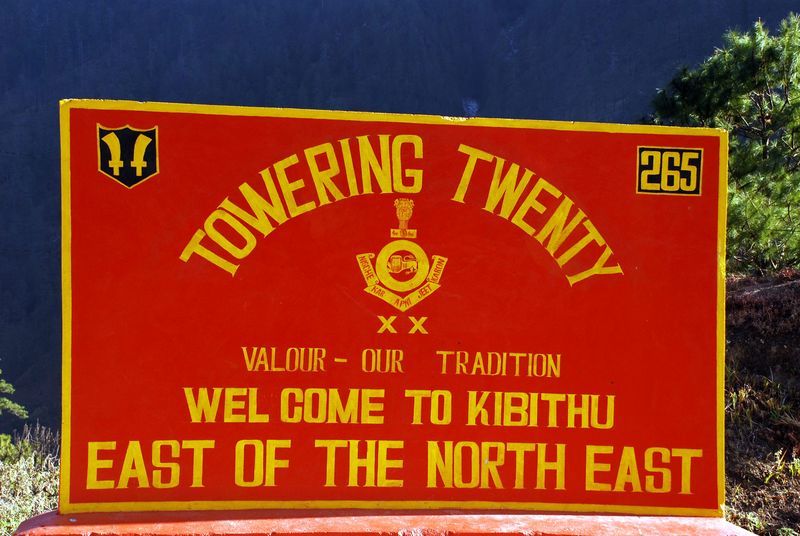
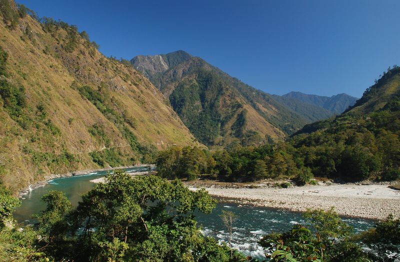
On completion of my basic military and professional training, I was deputed to Special Frontier Force and I had the proudest moment of my life when I visited the War Memorial in Walong, Lohit District, North East Frontier Agency (NEFA) during 1972. I got married during January 1973, while I was serving in the North East Frontier Agency and Lohit River is my witness to my Life’s Journey and Commitment.


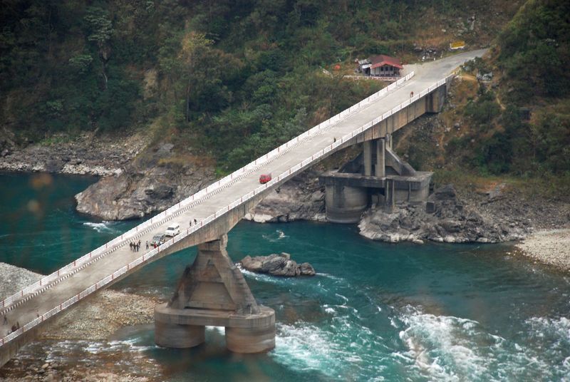
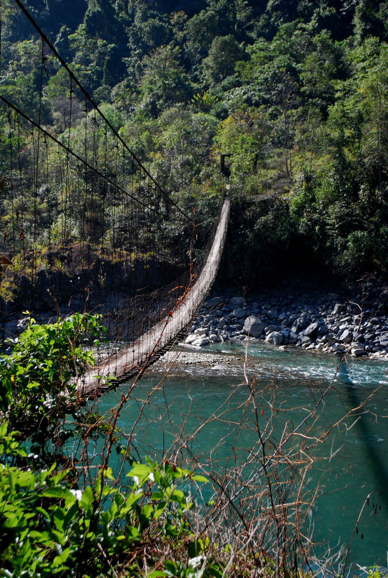
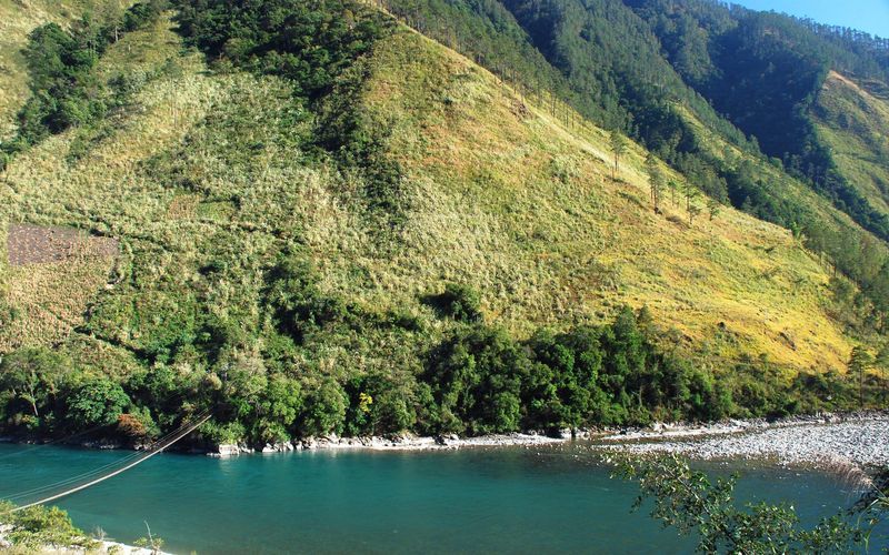
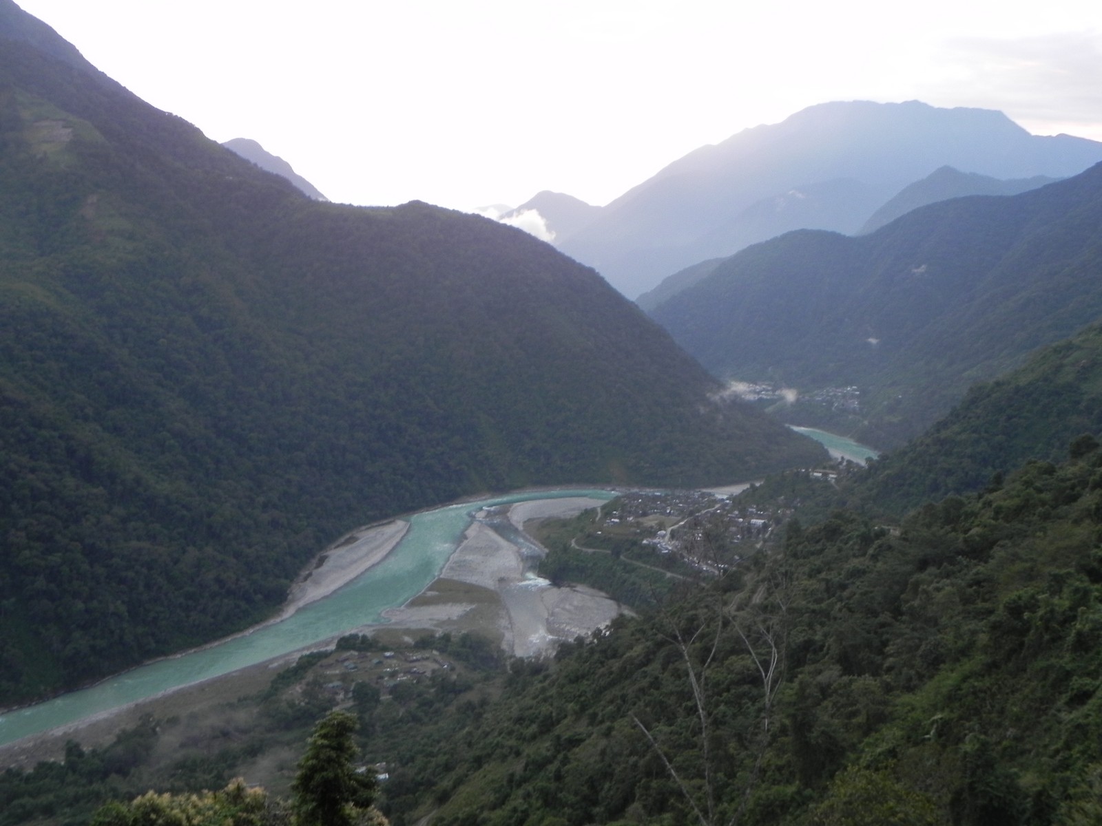
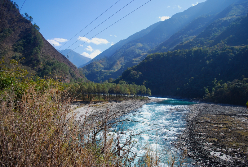
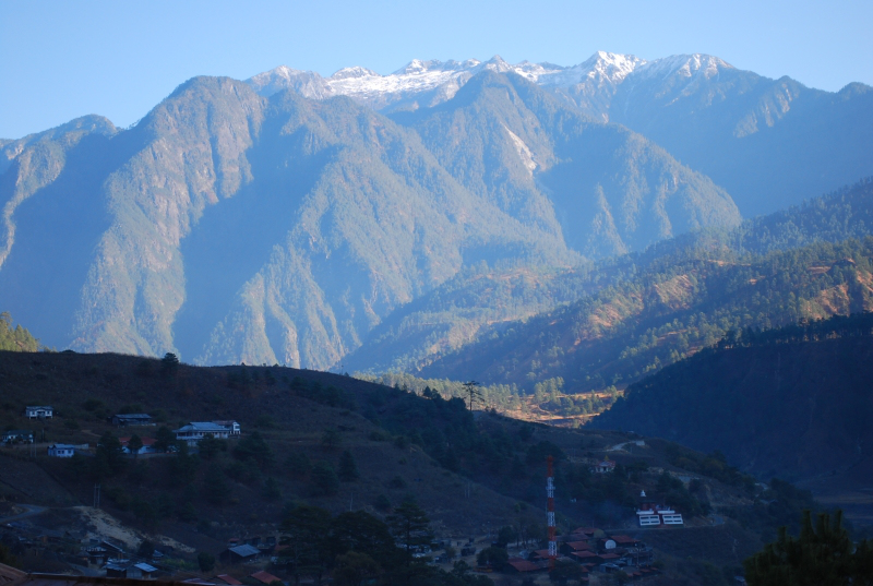
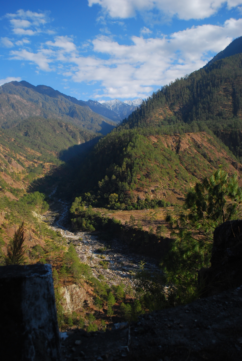
I am pleased to share an article titled ‘China opens new highway near Arunachal Pradesh Border’ written by Ananth Krishnan that was published in the HINDU on November 01, 2013. I had served in that area and the military organization in which I had served discouraged photography and I did not take photos of the natural scenery of that area. I would like to share some photo images published by http://GreenerPasturesInd.Wordpress.com and others, particularly the images of Lohit River that flows down the Anjaw District of Arunachal Pradesh.
The North East Frontier Agency (NEFA) was constituted in 1912-13. To settle the border between India and Tibet, Sir Henry McMahon, Secretary in the Indian Foreign Department represented Great Britain at a conference held in Simla during 1913-14. The Simla Accord or Simla Agreement between India, Tibet, and China resulted in the McMahon Treaty and the McMahon Line established the official border between India and Tibet. India after gaining her independence and after becoming an independent Republic has ratified the McMahon Treaty. People’s Republic of China which came into existence during 1949 had opposed this Treaty and had occupied Tibet during 1950 rejecting the status of Tibet of being an independent nation. The Communist China’s occupation of Tibet has posed a military threat to Peace and Democracy in Southeast Asia and Tibet’s Head of State, His Holiness the 14th Dalai Lama fled to India during March 1959 as a consequence of China’s repressive, brutal military actions. On August 26, 1959, in this northeast frontier sector, China’s People’s Liberation Army crossed the McMahon Line for the first time to capture an Indian border post. China abandoned this post during 1961 and launched a major offensive war during October 1962 attacking Indian Army positions in the entire North East Frontier Agency. Due to the firm intervention by the US President John F. Kennedy, China declared unilateral ceasefire and withdrew its forces from all the areas it had captured in the North East Frontier Agency. One of the consequences of this 1962 War of China’s Aggression on India was the creation of a military alliance/pact between India, Tibet, and the United States to defend the border and to challenge the military occupation of Tibet. This military pact/alliance has established a military organization called Establishment No. 22 which is later given the name of Special Frontier Force. I had served in Special Frontier Force along with Tibetan soldiers and we were defending North East Frontier Agency during that period of my military service. The North East Frontier Agency became Indian Union Territory and was named Arunachal Pradesh on January 20, 1972. The State of Arunachal Pradesh was formed on February 20, 1987.

I arrived in Doom Dooma (Dum Duma) during February 1972 after my successful participation in the military action called ‘Operation Eagle’ which initiated the Liberation of Bangladesh on November 03, 1971 with attacks on Pakistan’s military border posts in the Chittagong Hill Tracts. The United States had withdrawn its CIA personnel from our Organization prior to the launch of Operation Eagle. However, our military alliance/pact withstood the test of the times. In 1972, CIA contacted my Unit in North East Frontier Agency and requested us for our assistance to plant monitoring devices to record data from China’s underground nuclear tests in occupied Tibet. China’s occupation of Tibet, it claims for Indian territory and China’s military build up still pose a grave threat to Peace and Freedom in Southeast Asia.


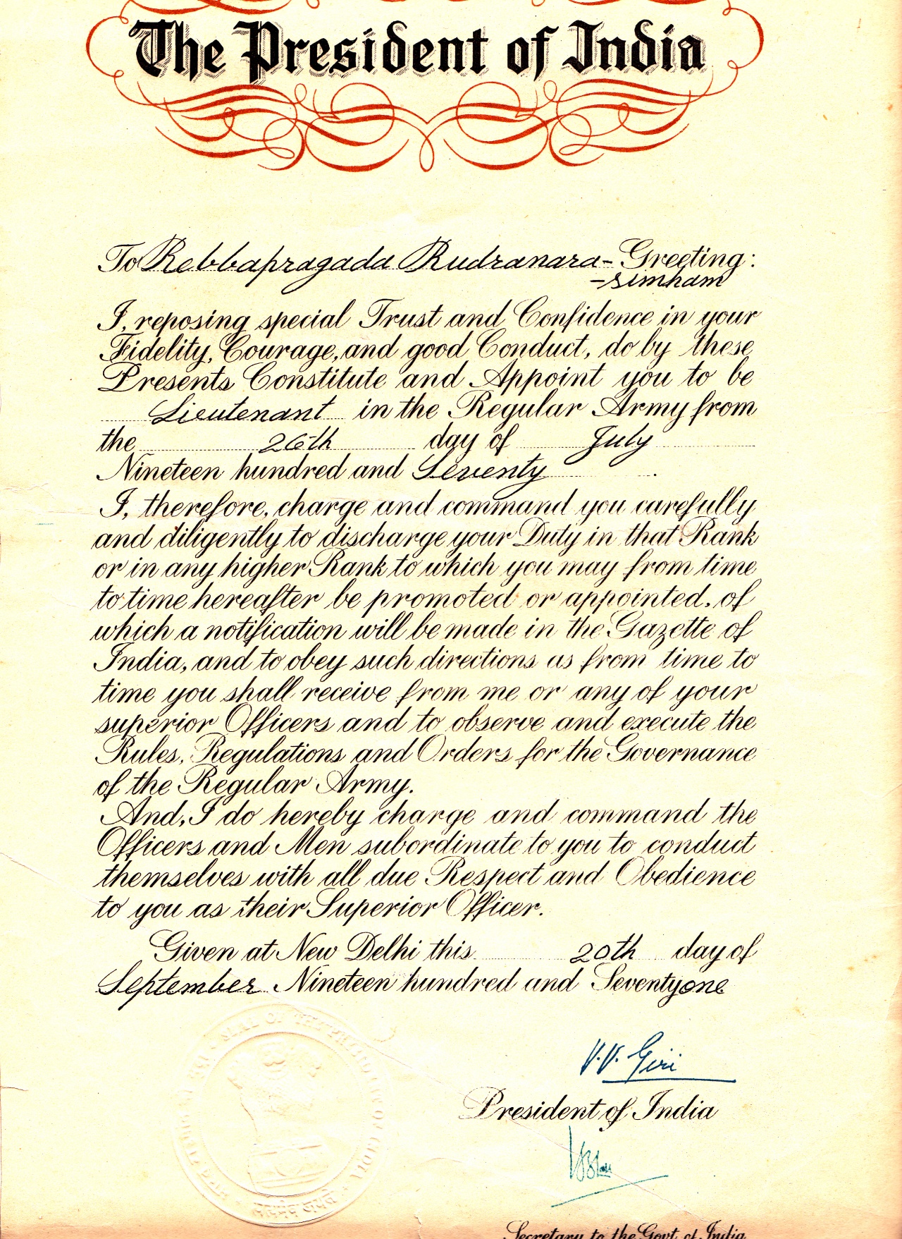
Rudra Narasimham Rebbapragada
SERVICE INFORMATION:

R. Rudra Narasimham, B.Sc., M.B.B.S.,
Personal Numbers: MS-8466/MR-03277K, Rank: Major,
Branch: Army Medical Corps/Short Service Regular Commission (1969-1972); Direct Permanent Commission (1973-1984).
Designation:Medical Officer.
Unit:Establishment No.22 (1971-1974)/South Column,Operation Eagle (1971-1972).
Organization: Special Frontier Force.
Published in the HINDU: November 1, 2013 03:14 IST
BEIJING, November 1, 2013
China opens new highway near Arunachal Pradesh border
Ananth Krishnan
Nearly 1 billion Yuan project comes to light after seven failed attempts over the past 50 years
China on Thursday opened a new highway that links what the government has described as Tibet’s “last isolated county” – located near the border with Arunachal Pradesh – with the rest of the country and will now provide all-weather access to the strategically important region.
Chinese state media have hailed the opening of the highway to Medog – which lies close to the disputed eastern section of the border with India – as a technological breakthrough, with the project finally coming to fruition after seven failed attempts over the past fifty years.
China started attempting to build the highway to Medog – a landlocked county in Tibet’s Nyingchi prefecture – in the 1960s, according to State media reports, in the aftermath of
the 1962 war with India.
With Thursday’s opening of the road, every county in Tibet is now linked through the highway network, underlining the widening infrastructure gulf across the disputed border, even as India belatedly pushes forward an upgrading of border roads in more difficult terrain.
The official Xinhua News Agency on Thursday described Medog as “the last roadless county in China”. Before this week, Medog was the only one of China’s 2,100 counties to remain isolated from the highway network, according to State broadcaster China Central Television (CCTV).
What the project will do
State media reports have focused on the development benefits that the project would bring and have sought to play down the strategic dimensions. Local officials said the road’s opening will bring down commodity prices and widen access to healthcare.
The road will also provide access to the border county for nine months of the year. That the government was willing to spend as much as 950 million Yuan – or $ 155 million – on a 117-km highway, with ostensibly few economic returns expected, has underscored the project’s importance to State planners.
Local officials said prior to the opening of the highway, reaching Medog required traversing the treacherous Galung La and Doxong La mountains at an altitude of 4,000 metres. With frequent landslides, the road was often rendered impassable.
Now, the road will be accessible for “8 to 9 months per year, barring major natural disasters”, Ge Yutao, Communist Party head of the transportation department for the Tibet Autonomous Region (TAR), told Xinhua.
Work on the 117-km road began in 2009, a year after the project was given the green light by the State Council, or Cabinet.
Renewed attention on infrastructure projects
The opening of the road comes at a time when there has been renewed attention on infrastructure projects in border areas in India and China.
Last week, both countries signed a Border Defence Cooperation Agreement (BDCA) during Prime Minister Manmohan Singh’s visit to Beijing, aimed at expanding confidence-building measures. The agreement calls for setting up channels of communication between military commands, increasing the number of border personnel meetings, and formalizing rules such as no tailing of patrols, to build trust and avoid incidents.
The agreement does not specify or limit either country’s plans to boost infrastructure – an issue that, analysts say, has in the past triggered tensions along the disputed Line of Actual Control (LAC), most notably in April when a Chinese incursion sparked a three-week-long stand-off in Depsang, Ladakh.
Han Hua, a South Asia scholar at Peking University, suggested in a recent interview that the “basic reason” for the incident was “too much construction” along the border. The Chinese side, she acknowledged, did not have to build closer to the disputed LAC because their infrastructure, as well as more favourable terrain enabled quicker mobilisation.
“If we don’t have the overall collaboration of the military, policy-makers and decision-makers on both sides,” she said, “it will be difficult to avoid such incidents.”
‘India’s plans will not be limited’
The BDCA, Indian officials said, will not limit India’s plans to upgrade infrastructure. It recognises the principle of equal and mutual security, which allows either side to pursue its security in its own way. At the same time, officials say the BDCA will still help “regulate activity” along the border by opening up new channels of communication, even as the border continues to remain a matter of dispute.
On Thursday, Chinese Defence Ministry spokesperson Yang Yujun told a regular press conference that military personnel would hold “regular meetings” and “make joint efforts” to maintain peace in border areas, following the signing of the BDCA. The agreement, he said according to a Xinhua report, “summarised good practices and experiences on the management of differences in China-India border areas”.
Keywords: Sino-Indian border, Arunachal-China border, infrastructure, Tibet Autonomous Region


Leave a comment